


Choose an orbit, run your model, and receive processed insights instead of raw data. At just $375 for a full orbit.
Your lab.
MoI orbits in LEO, carrying 117 TOPS of compute and a 9-band imager with precision pointing to match. The infrastructure is live. The orbit is yours to task.
Our orbit.
You are in command!
(and control)
Commanding a satellite — pointing it, tasking it, directing its attention to a precise location on Earth — has historically required dedicated ground control infrastructure, specialist teams, and budgets that kept it firmly in the hands of space agencies and defence programmes. OrbitLab is here to challenge and change that. But commanding the satellite is only telling half the story.


Step 1: Task
From the Cesium-powered 3D dashboard, track MOI's live position, define your Area of Interest, and configure imaging parameters — spectral band selection, off-nadir angle, sun elevation. Schedule your pass.
* Ground station uplink and downlink windows are generated automatically.

Step 2: Test
Deploy to the sandbox environment first. Validate your model, your AOI configuration, and your orbital parameters before anything reaches the satellite. The OrbitLab Assistant is available throughout.

OrbitLab doesn’t just give you control of the satellite. It gives you control of the processing. Your model runs on-orbit during the pass. Only the insights come back — validated, actionable, and in your dashboard within 5–15 minutes of capture. The traditional alternative takes 24–72 hours. By then, the moment has passed.

Step 4: Receive
Processed insights arrive in your dashboard within 5–15 minutes of capture — alongside validating data. Not raw imagery. Not a file to process. Conclusions that you can act upon.
Your dashboard displays status of all jobs
Varied set of libraries for quick implementation
Step 3: Deploy
Push your validated task to the satellite. Choose deployment — native application, Docker container, or ONNX model. Your code runs on 117 TOPS of on-orbit compute, never leaving the satellite.
Commanding a satellite — pointing it, tasking it, directing its attention to a precise location on Earth — has historically required dedicated ground control infrastructure, specialist teams, and budgets that kept it firmly in the hands of space agencies and defence programmes. OrbitLab is here to challenge and change that. But commanding the satellite is only telling half the story.
Running Tasks in Space 101


If it can be detected from LEO, OrbitLab can run it.


If it can be detected from LEO,
OrbitLab can run it.
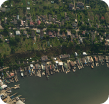
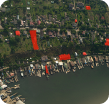
Change Detection
Monitor large areas for surface changes between passes. Construction, deforestation, land use shifts — flagged automatically.

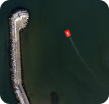
Object Detection
Locate specific objects within your AOI. Vessels, vehicles, structures — anything your model is trained to find.
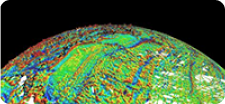
Anomaly Flagging
Detect deviations from baseline before they’re visible on the ground. Crop stress, heat signatures, spectral anomalies.
IP-Protected Inference
Your models execute on-orbit and never leave the satellite. When it comes to proprietary algorithms, this isn’t a feature — it’s a requirement.
Custom Inference
Your model, your logic. OrbitLab runs any task your model is built for — classification, regression, segmentation, or time-series analysis.
Pre-loaded and ready
A library of foundation models already cached on the satellite for geospatial analysis, object detection, semantic segmentation and vision-language tasks.
“Houston, we don’t have a problem!”
Help is at hand. Everything you need and nothing you don’t.
OrbitLab is a complete environment for orbital applications — from your first uploaded model to your first result from space. Access via gRPC from Python, C++, Node.js, or any language. Works seamlessly from Docker containers. Chain multiple operations for complete pipelines.

OrbitLab Workstation
A remote GPU environment pre-configured for satellite application development. OrbitLab libraries included. Connect, upload, and build — no local setup required.

Dev Documentation
Platform hardware, storage architecture and environment specs. Application guides covering standalone deployments, Docker containers & ONNX models. Libraries for Geospatial, AI/ML, Computer Vision, Data Formats, and Scientific computing.

Task History
Every experiment, logged and accessible. Track the status of scheduled and completed tasks, review sandbox results, download output files, and push validated models directly to the satellite — all from one view.

OrbitLab Assistant
An AI assistant trained on all OrbitLab documentation. Ask it anything — platform capabilities, deployment parameters, or application behaviour — and get an answer grounded in how OrbitLab actually works.
If you have the idea,
we have the hardware to test it in LEO.
MOI Specs
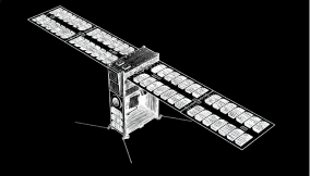
OrbitLab runs on TakeMe2Space’s MOI satellites — purpose-built for on-orbit compute. Each satellite carries 117 TOPS of processing power, a 9-band multispectral imager with 9m ground resolution across a 19.15km swath, and RadShield-protected electronics rated for the radiation environment of LEO.
Vision Processing Pipeline
Raw sensor data is processed through three stages on-orbit.
L0 to L1a handles calibration — debayering, dark frame correction, flat field correction, GPU acceleration.
L1a to L1b/L1c handles radiometric, atmospheric, and geometric correction, plus orthorectification.
L2 delivers analysis-ready outputs — cloud masking, vegetation indices, water detection, change detection, morphological operations.
Command a satellite at $4/minute.
The sandbox is free.
(That’s the end of our pitch.)
Developers
Full platform access, 3D visualisation, and sandbox testing — completely free. Pay only when you task a live satellite.
Enterprises
Discuss volume pricing, dedicated satellite capacity, or a custom deployment with our team.
Academia
Special pricing for universities and educational institutions at $200 per orbit for teaching and research.

807 petabytes of Earth imagery are captured every year. Less than 10% ever reaches the ground — lost to limited downlink windows, scarce ground stations, and transmission costs that don’t scale. What does reach the ground still takes 24–72 hours to process and deliver. TakeMe2Space saves time and money by deploying intelligence in space.
The bottleneck isn’t the satellite. It’s what happens after.